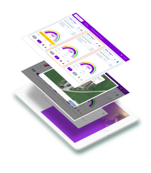
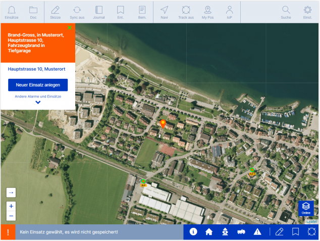
Firetab Einsatz Mobile mission control
Is the mobile solution for immediate retrieval of mission-critical information. Displays alarm message, event location at a distance from the magazine and all mission-relevant data. Also serves for the preparation of situation sketches. Works on- and offline on iOS and Android!
Firetab insert
Software features This is what the deployment application offers
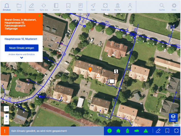
Deployment Management
- Display of the alarm message
- Selecting and saving an operation
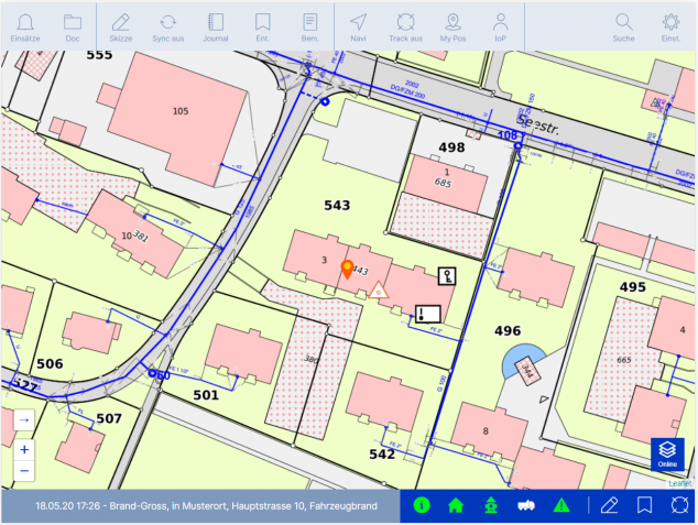
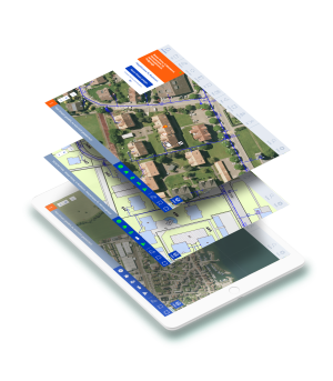
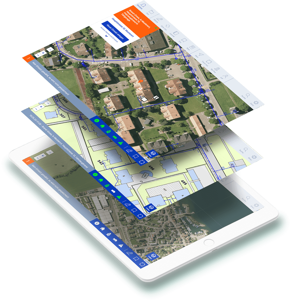
Cards
- Orientation via selectable general map views
- Fire department specific map views: Cadastre,
hydrants, gas, waste water, flood protection etc. - Smooth integration of WMS maps from a GIS
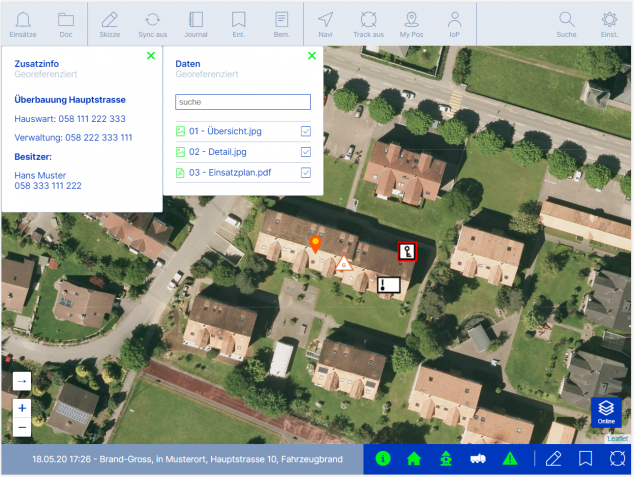
Information
- Clear display of object-related data (symbols, files, photos, drawings) on different levels
- Printout of stored files and site plans
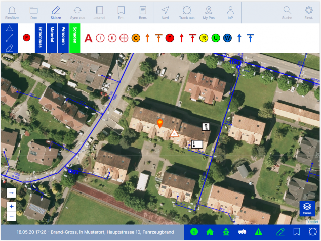
Location sketch
- Drawing position sketches with offline synchronization
- Managing your own symbol libraries
- Synchronization among the tablets and the web application
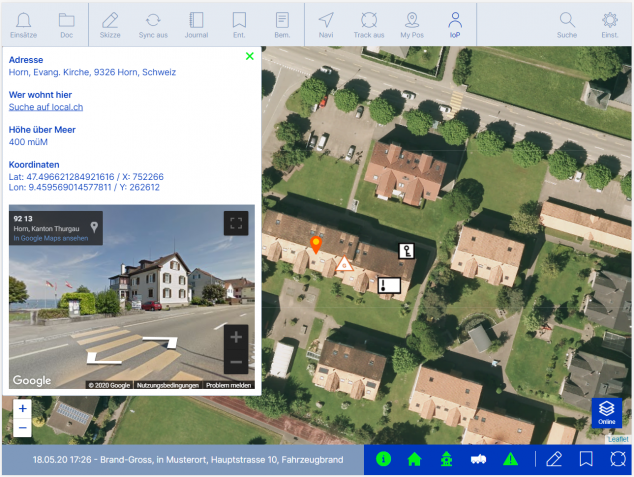
Information of Point
- Intelligent address search by clicking on map
- Display of coordinates and meters above sea level
- Link to local.ch for people search
- Information and Google Street View image of the object
Add-on: Navigation & Tracking
- Intelligent detection of the event location at a distance from the magazine
- Directions navigation
- Displaying the positions of registered tablets
- Incorporating GPS trackers for vehicle location display
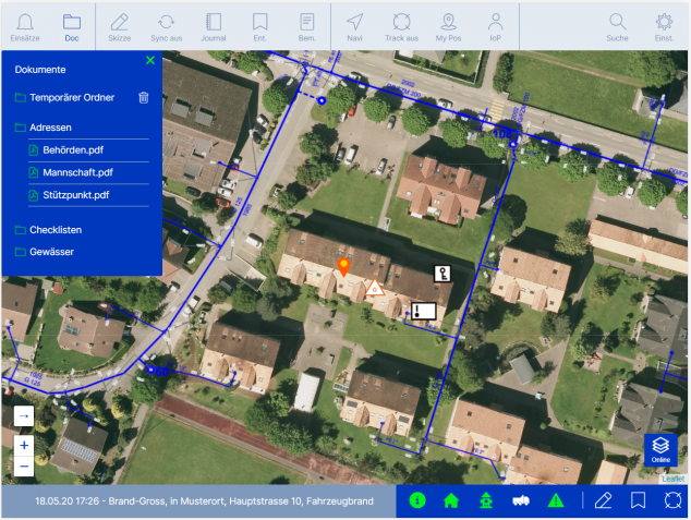
Add-on: Document storage
- Storage of non-georeferenced documents


Pricing
In a flexible subscription system.
Something for everyone.
Transparent.
The software licenses are paid quarterly, half-yearly or annually. Against invoice or with credit card. We offer various packages. Subscription changes are possible at any time. Start using Firetab now!
With Firetab insert Are you more efficient in all phases of operation
You want a free one-hour product presentation and choose the day and time?