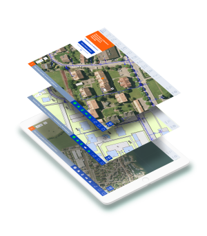
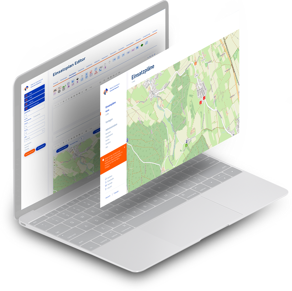
Planbutler Digital deployment planning

Planbutler is our application for creating and managing operational plans, building plans, area plans and maps. Planbutler is specialized in visualizing spatial data and object information. Create documents quickly, edit them at any time and access them on the go - that's what it's all about.

Plans

Create deployment plans and documents without spending a lot of time.

Exercises

Create exercise documents quickly and edit them on the go.

Position sketches

Draw location sketches digitally thanks to integrated tools and maps.

Tools

Use helpful tools of the application and work professionally.

Drag & Drop

Drag and drop photos and files to upload them in different formats.

Listen

Manage documents in list form independently as a team.

Planbutler

Self-explanatory.
Professional.
Inexpensive.

Planbutler is a professional software for deployment planning as well as for GIS systems that anyone can use.

Deployment plans software planbutler

Planbutler advantages High standard with many upload options

6
Cards in standard
3
Symbol pools in the standard
6
Templates in standard

Cards

See documents georeferenced and add your own maps.

Symbols

Use official symbol databases and add your own symbols.

Templates

Use system templates as well as save and reuse your own templates.
For fire department
For civil defense
For big event
For companies

Fire department

Create and retrieve deployment plans easily and quickly

PlanButler is the smart software for volunteer fire departments, local fire departments, base fire departments and company fire departments for deployment planning.

Civil Defense

Civil defense organizations use Planbutler for their documents

Special elements for civil defense are integrated in Planbutler: for creating plans and exercises. The symbol databases of the Civil Defense are also included. The app digitizes civil defense.

Major event

Use Planbutler for security at major events

Planbutler are ideal for organizing emergency forces at major events. Especially when different organizations work together and volunteers are also involved.

Company

Companies, with infrastructure benefit from own GIS system

Organizations and companies that manage plans for their infrastructure will find the ideal application in Planbutler. Edit plans, save plans and info georeferenced and work mobile: everything is possible.

Satisfied customers From fire chiefs to safety chiefs

"Planbutler convinced me very much and I am happy to recommend the app for use at large events."

Andreas Müller, Head of Rescue Service Canton Zug / Head of Operations ESAF 2019

"Especially during the Corona crisis, when we couldn't hold fire drills, we made good use of time from home to use Planbutler to create deployment plans for the Firetab. We would never have been able to work that efficiently before we got the apps."

Claudio Forster, Commander Horn Fire Department

"With Planbutler, we were able to close a gap in the area of creating deployment plans. The ability to transfer schedules directly from Planbutler to Firetab simplifies the process a lot and saves us time in Firetab administration."

Fernando Volken, Chief of the Oftringen Fire Department

"Planbutler has impressed us. The app is simple, practical, and time-saving when there are a lot of support staff on the job!"

Daniel Jauch, Commander FFZ, Head of Operations ESAF 2019

Planbutler functions Helpful tools for digital documents
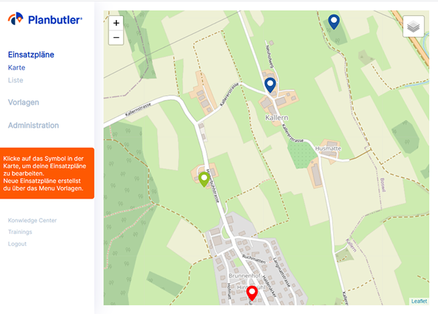
Operation plans-fire brigade

Operational plans

  • Georeferenced view of all plans
  • Insertion of own images and PDFs
  • PDF export of all application documents
Fire department deployment plans

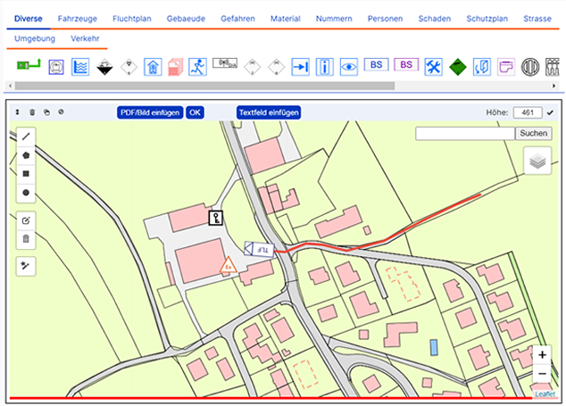
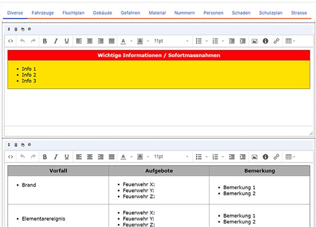
Operational documents

  • Drawing sketches directly on any WMS map
  • Text fields with many formatting options
  • List view of documents with filter function
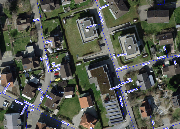
Map WMS

Cards

  • Working with different system maps
  • Inserting your own GIS maps via WMS interface.
  • For example: Hydrant, gas, electrical, cadastral map
Fire Department Response Plan Templates

Templates for fire departments

  • Predefined templates for CH, DE, AT
  • Create your own templates
  • Template editor with extensive functions
  • Symbol library for CH, DE, AT
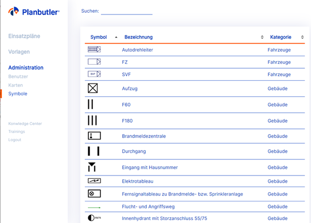
Symbols-Mission Plan-Fire Department

Administration

  • Simple user management
  • 3 user rights: administrator, worker, viewer
  • Select symbol set
  • Manage subscription
  • Transparent cost overview

The Azurito Cockpit

Edit all apps independently and centrally

A digital ecosystem needs to be cleverly controlled. That's why there's the Azurito Cockpit, where you're the boss of your apps.

Simply individualize solutions

Many of our modules and features are individually configurable. Design your own solution - clear and simple.

Add more modules and apps at any time

Build your digital system independently. Extensions are possible at any time. A step-by-step approach is usually the best way to digitize.

Make uncomplicated changes to the users

Manage users, roles and subscriptions independently. No team remains the same over time. You make adjustments mobile, fast and independently.

Use central knowledge database

New users will find valuable information in the integrated Know-how Center. There are answers, guides, and videos on how to use the apps.

Configure and manage apps

Planbutler

Work on your plans wherever you are.

Thanks to cloud solution, you can access and edit your documents from anywhere.

Software scheduling - mobile working

Work in a team with clear roles.

There are 3 different roles that you can assign to your team members.

Deployment Tablet Firetab

Have your plans handy in any situation.

On your smartphone you always have your documents with you.

Software deployment plans - Mobile

Pricing In a flexible subscription system.
Something for everyone.
Transparent.

The software licenses are paid quarterly, half-yearly or annually. Against invoice or with credit card. Changes are possible at any time.

See prices

Our mission Your area and objects with your info

Every person, fire department or company creates its own geographic information system (GIS) in a few steps. Likewise operational plans, disaster plans, object plans and situation sketches.

Apps Download

The apps are always available for download in the stores. To get started, please contact the Azurito team.